Monache Meadow is a hard-to-get-to camping area in Inyo National Forest. But if you can get there, it’s pretty epic.
It’s hard to get to because the only way in by vehicle is a 4×4 jeep road that most cars can’t conquer. You can hike in but that’s even more difficult. Hiking routes from Kennedy Meadows on the Pacific Crest Trail, or over Olancha Pass, are long and strenuous. Hiking the jeep trail would actually be the fastest and easiest route on foot.
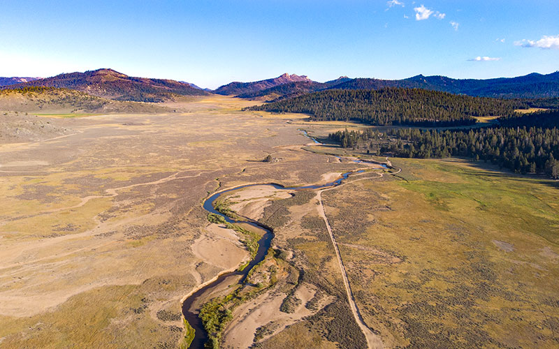
It’s epic because it’s beautiful. Surrounded by tall granite peaks and forests, the revered South Fork Kern River flows here, known to fishermen for its native golden trout. I wrote a longer blog post about my time in Monache Meadow HERE.
The map below pinpoints some of the best camping sites in Monache Meadows. Most are in the trees on the edges of the meadow. Some have excellent views of Olancha Peak.