The real jackpot in Las Vegas goes to local hikers.
Everyone wins here thanks to dozens of excellent trails in every direction. To the west is Red Rock National Conservation Area, while to the east is Lake Mead National Recreation Area. To the south is Sloan Canyon National Conservation Area, and to the north is the National Desert Wildlife Refuge and Valley of Fire State Park.
As a new Las Vegas resident, I’m pleasantly surprised by the large number of great hiking options.
The following is a brief description of my favorite trails, which by no means comes close to covering every trail to try.
Hiking is popular during the cooler months of the year. From June 1 into September, many trails are actually off limits because of the dangerous heat.
Las Vegas Hiking Trails
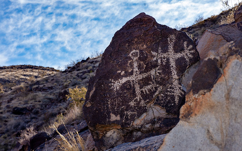
Petroglyph Trail
Located on the edge of Henderson is the largest collection of native rock drawings in Southern Nevada according to the Sloan National Conservation Area website. This two-hour hike is relatively easy but does include some rock hopping. The petroglyphs are well preserved and abundant. While the petroglyphs are no doubt the jewel of the trip, there’s some nice views of Las Vegas while returning downhill to the trail head.
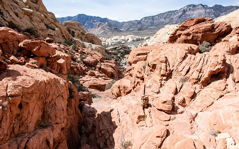
Calico Tanks – Red Rocks
Red Rock Canyon National Conservation Area is home to numerous excellent hiking trails. Calico Tanks is a popular one that shows off some of the best namesake rust-colored terrain.
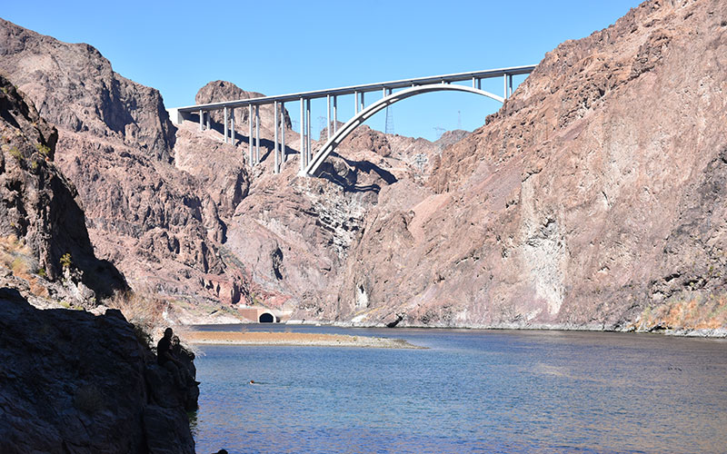
Gold Strike Canyon
Gold Strike Canyon is one of my favorite hikes in the Las Vegas area. The trail descends through a sandy wash that has a few sections with boulders the size of houses that require ropes to climb back up. The trail ends at the Colorado River at the bottom of Black Canyon near Hoover Dam. Just before you get to the river, there’s several pools filled by hot springs to enjoy.

Black Mountain – Henderson
Black Mountain is the highest point in Henderson at the southern end of the valley. It’s a steep climb but the round trip can be done in 4 hours and the views are awesome.
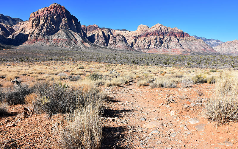
Oak Creek Trails
The flat desert area in front of Rainbow Mountain and Wilson Peak has a series of trails that start on Highway 159. These trails form a large network through the Oak Creek area where jackrabbits and coyotes traverse the high desert through numerous Joshua Trees and Cholla cacti.
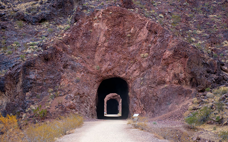
Railroad Tunnel Trail
The Railroad Tunnel Trail is a great way to see Lake Mead and experience the history of Hoover Dam. The trail passes through five enormous tunnels bored for the railroad that supplied the Hoover Dam building operation in the 1930s. Today’s trail is a 3.5-mile, flat walking path that connects the Lake Mead Visitors Center and Hoover Dam. When not walking through the dark tunnels, hikers enjoy sweeping views of Lake Mead and surrounding mountains.
Gass Peak
This one is a toughie. About 2,500 feet of elevation gain on a remote, rugged desert mountain. Once at the top, at elevation 6,937, your reward is excellent views of the Las Vegas valley. Views stretch all the way to Arizona, California and Utah. The trailhead is located in the Desert National Wildlife Refuge and you’ll need a 4-wheel drive vehicle to get there.
White Rock Canyon
A network of trails in this area includes routes to the Colorado River, hot springs, and the Liberty Bell Arch. Access is from Highway 93 on the Arizona side of the river a few miles south of Hoover Dam.
Ice Box Canyon
Another trail in Red Rock Canyon, Ice Box is known for a seasonal waterfall. Here’s a link to all the hiking trails in the Red Rock park.